Saturday, 8 May 2010

Bluebell Lane Circular

A nice gentle circular today - Parked up on Upper Raby Road and set off along School Lane. An easy, wide path that goes dead straight and runs behind Hinderton Grange towards Quarry Road. A few blue bells and plenty of new leaves give the lane a soft edge. This is Neston FP65.


Turn left at the end of School Lane and proceed along Quarry Road - and ahead you will see the impressive sandstone buildings on the sharp bend where Quarry Road road turns right and Bluebell Lane goes straight on, becoming a bridleway (Neston BR60).

We turned left through the kissing gate and along the edge of the field, following the hedge. (Ellesmere Port FP43) The hedge hides an interesting drain that appears to have a sandstone wall on at least one side. There was some beautiful pink blossom in amongst the hedge that smelt as good as it looked.

The path soon turns right and through the hedge (and into Merseyside) and we find ourselves in a bluebell strewn wood, the path winding around trees and then along the side of cow fields where we saw a hare and there was just one drill from a woodpecker. Sadly the sun choose to go behind clouds at that point, so we missed out on the pictures we were after, better try again next week.

The path turns sharp right and by now is Neston FP59, and passes Field House and Cherry Farm before bringing us back where we started. A nice little circular.


Tuesday, 13 April 2010

Saughall via Shotwick

Just arrived home from a 4 hour grand walk.... more later!

Monday, 12 April 2010

Puddington before dinner

A quick stroll after work and before dinner to celebrate the warmer weather, though it is still a little crisp.

We parked the motor out of the way at the side of the road in the dip as you approach Puddington from Burton. The footpath sign is hidden behind a home watch sign, but the sandstone steps are a bit of a give away and most people seem to use the cattle grid anyway. A wide and surfaced path follows the brick wall boundaries on one side, a ploughed field on the other. This is Neston FP67 for a few yards, before turning into Puddington FP7 - probably at the substantial kissing gate - 2 of these - good! This path crosses a working farm yard so take care. Puddington is a well healed and well looked after cluster of buildings, many are converted from their previous use into dwellings, there is an old hall marked on the footpath map and it certainly feels a bit conservative. Wikipedia has little to say....

Cross the lane at the end of this path and there is another path at the side of the house - a nice little path with a green field on one side and fibre glass sheep on the other - really. It curves around and soon ends back on the road. That's 3 paths in 5 minutes.

Turn left and follow the road and you soon happen upon a classic cast iron finger post sign in faded and rusted black and white paint. Follow this finger and you are on Puddington FP1 (Pipers Lane) - we passed sheep lambing and continued on up the lane - for this is a farm road, wide and metalled for a good while, passing through a number of little metal swinging gates that I don't recall ever seeing before. The gates around here are mounted on some fairly light rails - I should measure one I suppose - light standard gauge I think rather than narrow gauge. From farm into stud farm - a modern mansion of a place on the left with grand brick gates and new brick buildings - then suddenly we are back in the fields, following an ancient ditch with a hedge either side.

Into a stand of trees and there seems to be a choice. Checking the map, the footpath continues over the stile on the right and across a field towards the farm. The worn path seems to go left through the trees, but is just a locally used path to the fields beyond via a small wilderness of downed trees, stagnant waters and bluebells. However there are rooks, tits, a woodpecker, finches and goodness knows what else in this stand alone.

We turned back here and were rewarded with an apricot hued sunset, an owl being mobbed by every crow for miles around - it flew off and was passed between the crows as it went, each one
having a pop before backing off. Rabbits everywhere and a vast quantity of holes in the ground that looked big enough to be badgers.

There is a block of old modern houses at the start of this path, all empty bar one - another development in waiting?


Sunday, 11 April 2010

The A5 - eh?

Yes the A5 - that iconic road linking London to Holyhead. Actually it's the old A5 - a 3.7 section of the old coach road that used to link Capel Curig with Ogwen that was made redundant by Thomas Telford's better engineered A5. Now reclaimed from being churned up by the off road brigade, this now forms a public path with a cafe, toilets and car park at either end, and even has a bus service if you only want to walk one way....


We chose to try a section on my birthday treat weekend to get away from all those trains - there was snow everywhere and quite a lot of it too - the path starts from the roadside just south of Ogwen - you can park right there if you want too - and sets off towards the imposing mass of Tryfan before turning parallel with the road. We witnessed a great crowd of folk abseiling down a huge slab of rock soon after we started walking, and soon realised that this valley was far warmer than we had expected, so layers started coming off.


Underfoot though it was very soggy and muddy. The path is managed by the National Park Authority and while a lot of slate chippings have been laid in places, there is a lot of mud to negotiate. A great wooden bridge crosses a stream that appears to flood to about 4 feet deep at times and a little later there is another huge fold of rock pushed up from the earth to your right.

We peeled off the path at the camp site to climb up towards a reservoir on the other side of the main road - this afforded fantastic views up the vally towards Ogwen with so much snow on the mountains. The snow on the path up was patchy but well over knee deep in places - great fun!

We'll be back to walk the whole path soon I think.


Welcome & a walk

Welcome to a new blog.

We walk a lot and we like to walk off road and on footpaths. Footpaths, bridleways, tracks, permissive pathways, just about anywhere that is NOT a road with motor vehicles. Near were we live here in Little Neston, on the Wirral Peninsular, we are very lucky to have a network of paths that criss-cross the area, and we will be exploring these on a regular basis and reporting back here, so if you live local, we may reveal some exciting paths that you may not even be aware of.

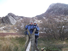
We won't just be writing about local paths though, we get out and about and we'll be writing about these paths too.

Little Neston to Thornton Hough - 11th April 2010

Today we set off on one of the first really sunny days of the year and started on the Wirral Way heading East up the cutting from Station Road. Turn left at the top of the cutting after passing under the Lees Lane road bridge and you pass through number of ponds, cross the car park and turn right onto Neston BR48 - this is a lovely lane with brooks on either side, it runs on a converging course to where Cuckoo Lane passes under the old railway line that is the Wirral Way. Turn left onto Neston BR49 (Cuckoo Lane), up the hill towards the A540.

Coming back to the old railway line - you knew I would - the old cutting is a slice through the local sandstone strata - you can see the layers and fault lines and no doubt other geological features. It produced wonderful icicles this winter and it is always damp. From railway point of view it seems very steep, I will look into this and report back.

Cross the A540 and continue along Hanns Hall Road and turn left onto Quarry Road until you reach the sharp left hand bend, ignoring for today the footpath on the left (Ellesmere Port FP16) . Here there is a choice of Bridleway (Bluebell Lane) or footpath Ellesmere Port FP43 which we take. This path follows the Cheshire boundary and we soon find ourselves walking through bluebell woods - everything is just in bud and there is a promise of many bluebells later in the year. From here Liverpool Cathedral just sits atop the land in the distance, across the fields of cows and crops. Here we saw three large birds of prey wheeling around on the thermals in the distance.

At a t-junction Neston FP59 goes left, but we turn right, into the Wirral Metropolitan area, then over a stile and right onto the wide farms track that leads along to Raby. At the metals gates there is a wooden fence to climb over (a sort of stile according to the slightly threatening looking farmer chap who watched us guessing). A couple of yards of very wet mud to cross lead to a second, then back onto the lane to the stile by Jasmine Cottage and the "Thatch" pub. The fence and mud arrangement could do with being easier to negotiate, but I suspect the chains on the gates may be a clue.

Turn left and right and there is a further footpath across the road that heads up a slightly muddy track to Yew Tree House on the B5136 Neston Road.

Our walk deviated before this point, but we'll leave it there for today. Butterflies much in evidence today and lots of birdsong - robins abound and blackbirds too, a really nice warm Spring day. We'll take some pictures for the next walks too.

These paths are mostly covered by Cheshire's great interaction mapping application here